MONET XArray Accessor
MONET can add georeferecing tools to xarray‘s data structures. These tools can be accessed via a special .monet attribute, available for both xarray.DataArray and xarray.Dataset objects after a simple import monet in your code.
Initializing the Accessor
All you have to do is import monet after you import xarray.
import xarray as xr
import monet as m
cmaqfile = monet.__path__ + '/../data/aqm.t12z.aconc.ncf'
from monet.models import cmaq
c = cmaq.open_dataset(cmaqfile)
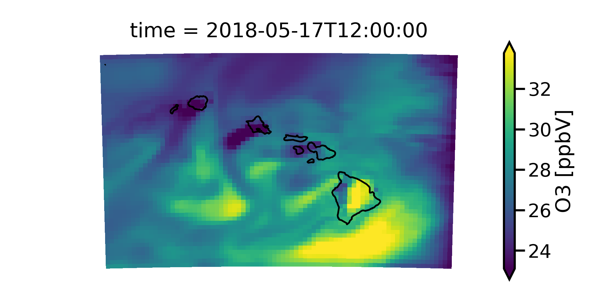
c.O3[0,0,:,:].monet.quick_map()
Interpolation Accessors
The MONET accessor provides several useful interpolation routines including: Getting the nearest point to a given latitude and longitude, interpolating to a constant latitude or longitude, interpolating to a vertical levels, and remapping entire 2D :py:class::~xarray.DataArray or :py::class::xarray.DataSet.
Find Nearest Lat lon point
To find the nearest latitude longitude point you just need to use the .monet.nearest_latlon method. In this example we will continue to use the CMAQ test file above. We will find the closest grid points to lat=20.5, lon=-157.4.
c.monet.nearest_latlon(lat=20.5,lon=-157.4)
<xarray.Dataset>
Dimensions:    (time: 48, x: 1, y: 1, z: 1)
Coordinates:
* time       (time) datetime64[ns] 2018-05-17T12:00:00 2018-05-17T13:00:00 ...
  latitude   (y, x) float64 dask.array<shape=(1, 1), chunksize=(1, 1)>
  longitude  (y, x) float64 dask.array<shape=(1, 1), chunksize=(1, 1)>
Dimensions without coordinates: x, y, z
Data variables:
  O3         (time, z, y, x) float32 dask.array<shape=(48, 1, 1, 1), chunksize=(48, 1, 1, 1)>
Notice that the length of the dimensions are now (time: 48, x: 1, y: 1, z: 1).
If you wanted to only find the nearest location for a single variable you can
use the accessor on the DataArray.
c.O3.monet.nearest_latlon(lat=20.5,lon=-157.4)
<xarray.DataArray 'O3' (time: 48, z: 1, y: 1, x: 1)>
dask.array<shape=(48, 1, 1, 1), dtype=float32, chunksize=(48, 1, 1, 1)>
Coordinates:
 * time       (time) datetime64[ns] 2018-05-17T12:00:00 2018-05-17T13:00:00 ...
   latitude   (y, x) float64 dask.array<shape=(1, 1), chunksize=(1, 1)>
   longitude  (y, x) float64 dask.array<shape=(1, 1), chunksize=(1, 1)>
Dimensions without coordinates: z, y, x
Attributes:
   long_name:   O3
   units:       ppbV
   var_desc:    Variable O3
   _FillValue:  nan